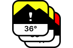
What are automatic cruxes?
Cruxes are the places along a route that are most critical in terms of terrain and avalanche danger. These are primarily slopes steeper than 30°. If spontaneous avalanches or remote triggering are possible, connected terrain and runout zones count as well.
White Risk automatically detects potential cruxes using the avalanche terrain maps and marks them in colour on the route. This helps you spot the places that need particular attention and draw the route precisely.
The automatic cruxes support your trip planning but do not replace your own assessment. A route can be exposed to avalanches even without an automatic crux. You can add places that are not marked as manual cruxes.